What is a 3D map viewer?
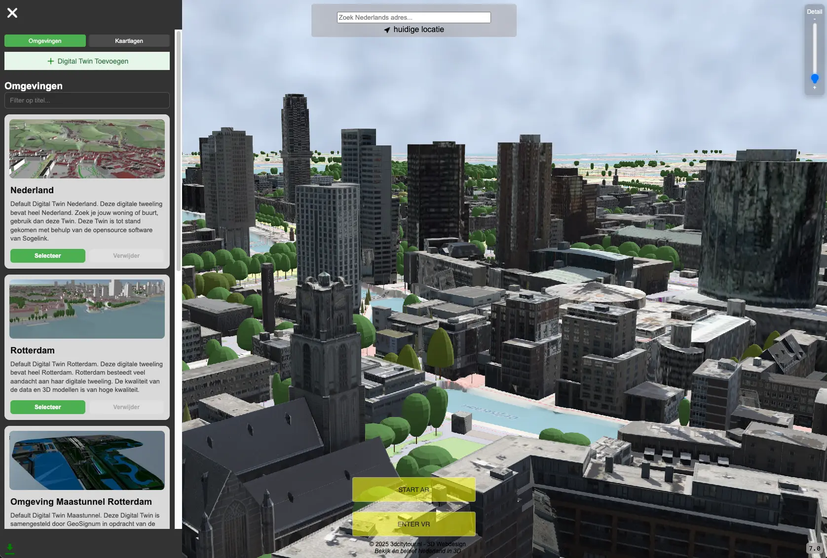
A 3D map viewer lets you explore geographic data directly in your browser as an interactive 3D environment. No software installation is required: the viewer runs online using modern web technologies such as WebGL, Three.js, Cesium and WebXR.
With 3DCityTour, you can explore the Netherlands as a digital 3D environment featuring real-world map layers, buildings, terrain models and experimental visualizations such as Gaussian Splats.
✓ 3D buildings and Digital Twin visualization
✓ Support for 3D Tiles
✓ Gaussian Splats and 3DGS visualizations
✓ WebGL, Three.js, Cesium and WebXR
✓ Works on desktop, mobile and VR
3D viewer features
The 3D map viewer brings together different types of geospatial data in a single interactive environment. Explore cities, neighborhoods, landscapes and objects from any perspective.
- Explore 3D buildings
- Display aerial imagery and map layers
- Visualize terrain and elevation differences
- Load and analyze 3D Tiles
- Display trees and urban objects
- Simulate shadows and sunlight
- Place objects and models in the environment
- Use Virtual Reality and WebXR
- Explore Gaussian Splats in a 3D map environment
Gaussian Splats on a 3D map
Gaussian Splats, also known as 3D Gaussian Splatting or 3DGS, make it possible to render photorealistic 3D scenes using imagery and point clouds. This technique is particularly suitable for buildings, objects, streets, interiors and realistic sections of cities.
In the 3D map viewer, Gaussian Splats can be combined with existing 3D map layers, buildings, terrain and Digital Twin data. This creates a hybrid 3D environment that brings traditional geospatial data together with photorealistic splat data.
- Visualize 3D Gaussian Splats
- Use PLY, SPZ or 3DGS data as a source
- Combine Gaussian Splats with 3D Tiles
- Place photorealistic objects in a map environment
- Suitable for experiments with Digital Twins and WebXR
Digital Twin of the Netherlands
A Digital Twin is a digital representation of the physical world. Combining 3D buildings, terrain, aerial imagery, trees, infrastructure and other map layers creates a virtual representation of the environment.
The 3D map viewer can be used for analysis, visualization, communication and experimentation in urban development, the built environment, mobility, sustainability and spatial planning.
- Urban analysis
- Spatial visualization
- Smart City applications
- 3D GIS and geospatial data
- Architecture and area development
- Education and public engagement
3D Tiles, WebGL and WebXR
The viewer uses modern web technologies to display large 3D datasets efficiently. With 3D Tiles, large collections of 3D buildings and objects can be streamed so that only the relevant parts of the environment are loaded.
WebGL and Three.js enable real-time 3D rendering in the browser. WebXR adds support for Virtual Reality and Augmented Reality.
- 3D Tiles streaming
- Real-time rendering in the browser
- LOD and levels of detail
- WebXR and Virtual Reality
- Interactive camera and navigation
- Support for large 3D datasets
Who is the 3D map viewer for?
The viewer is designed for anyone who wants to explore or analyze the Netherlands in 3D, from curious visitors to professionals working with geospatial data, 3D visualization or Digital Twins.
- Municipalities
- Urban planners
- Architects
- Property developers
- GIS specialists
- Researchers
- Educational institutions
- VR and WebXR developers
- Anyone interested in exploring the Netherlands in 3D
Frequently Asked Questions
What is a 3D map viewer?
A 3D map viewer is an online tool that lets you explore geographic data, buildings, terrain and objects directly in your browser as an interactive 3D environment.
What are Gaussian Splats?
Gaussian Splats are photorealistic 3D representations often created from photographs or scans. The technique is also known as 3D Gaussian Splatting or 3DGS.
Can I combine Gaussian Splats with a 3D map?
Yes. Gaussian Splats can be placed in a 3D map environment and combined with buildings, terrain, aerial imagery and 3D Tiles.
Does the viewer work without installation?
Yes. The 3D map viewer runs in your browser using web technologies such as WebGL, Three.js, Cesium and WebXR.
Can I explore the Netherlands in Virtual Reality?
Yes. The viewer supports experiments with WebXR and Virtual Reality, allowing you to explore parts of the Netherlands in VR.